Hole in the Clouds
May 24, 2010
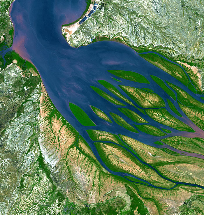
The Bestiboka River reaches the sea in the Mozambique Channel, along the northwestern coast of the island of Madagascar. There at the mouth of the river, ocean tides push saltwater upstream, slowing or even halting the downstream flow of the muddy river water; wherever the river pauses, sand and silt drop to the bottom of the bay, piling up into sandbars and islands.
In Madagascar's tropical climate, new sandbars quickly acquire a fringe of bright green mangrove scrub, which stabilizes the sediment and also shelters baby shrimp and other aquatic critters. Bombetoka Bay, the estuary here, is highly productive, especially for shrimp. The rectangular pens near the top of this picture are commercial shrimp farms.
The mangrove swamps along the lower reaches of the river trap vast quantities of sediment pouring down from upstream, which keeps the water clean and free of mud as it enters the bay; without this mangrove filtering, Madagascar's huge coral reefs just offshore (off the top edge of this picture) would soon die, smothered by sand.
birdseye view
Madagascar
satellite imagery
remote sensing
Bombetoka Bay
(Image credit: NASA ASTER satellite)
Jun 11, 2010
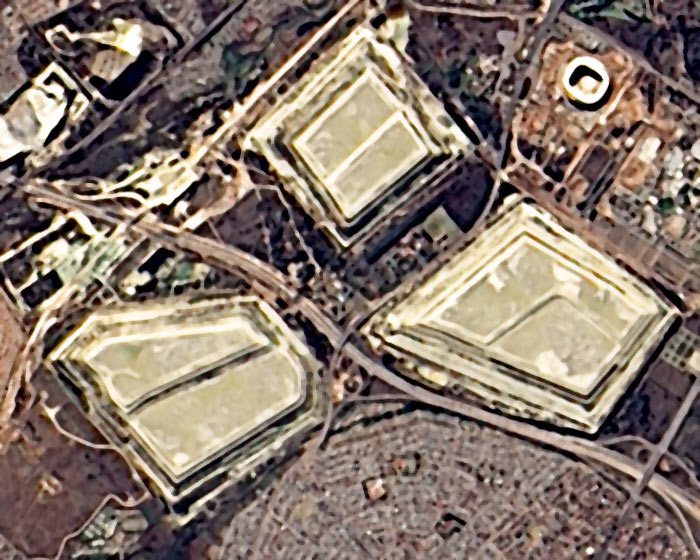
Last week, a NASA satellite flew over South Africa so its sensors could snap this picture of the soccer stadium, known as Soccer City, where World Cup action begins today.
The stadium itself is the white rounded rectangle in the upper right corner of the image. The three big grayish things in the middle are slag heaps, the rocky refuse of more than a century of gold-mining activity in the Johannesburg district.
At the bottom edge of the picture is part of Diepkloof, one of the neighborhoods of Soweto. When Nelson Mandela was let out of prison in 1990, he made his first public appearance in the Soccer City stadium. In this same stadium today, the South African national team challenges Mexico in the opening game of the FIFA World Cup; sadly, Mandela, once a soccer player himself and a lifelong sportsman, is said to be too frail to attend. He is 91 years old.
As this posting goes to, um, press, Mexico has just tied South Africa, 1-1, in the opening game.
birdseye view
satellite imagery
remote sensing
Johannesburg
South Africa
Soweto
Soccer City
mining
(Image credit: NASA Advanced Land Imager)
Oct 22, 2010
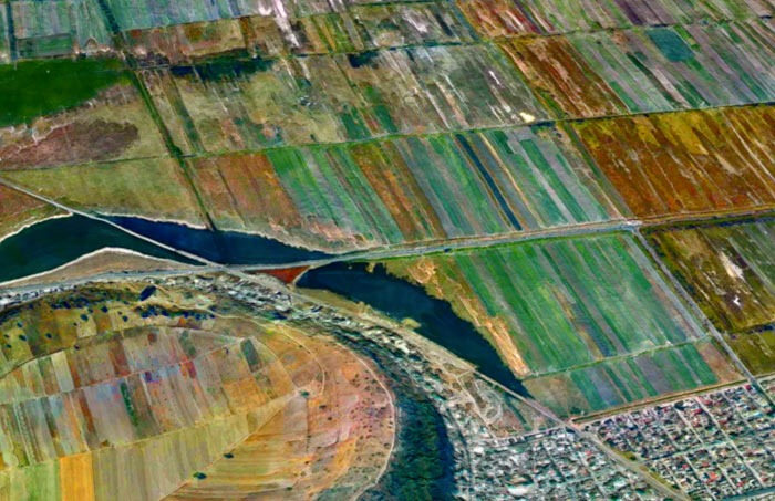
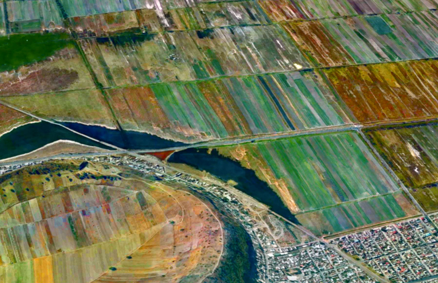
If you drop the first two letters of the name of the nation of Mexico, you get Xico, the name of several towns and landmarks around the country. There is, for example, the small hill town of Xico near Veracruz, where it is said that people do very little besides growing coffee and hosting bullfights. And here we see two other Xicos: a volcanic crater and the fast-growing city that surrounds it.
Xico volcano sits at the extreme southern end of the Mexico City megalopolis. For a geologically significant chunk of time, this area was underwater, drowned by Lake Chalco. The lake began to dry out in the 1300s, and Aztec fishermen settled along its coastline hereabouts. In the nineteenth century, the government drained the lake entirely; the fishermen were awarded communal land grants and told to become farmers.
Farming became intensive in the 1970s, when corporate agriculturists and desperate landless peasants struck illegal or quasi-legal deals with the communal organizations and wrested control of the rich volcanic soil. Thousands and thousands of families poured into the region, hoping for work. Farmers climbed over the rim of the volcano and plowed fields inside the crater. Xico the town sprawled right up to the ramparts of Xico the crater and appears likely to soon engulf it; in 2005, the population of the municipality was 330,000.
The urban fringes seen here lack the services and amenities taken for granted twenty miles away in downtown Mexico City. Xico's roads are mostly unpaved, schools are few and far between, and the people are almost all very poor. Now that NAFTA has dismantled the remains of the communal farming system, it seems to be increasingly the case that even the rich volcanic soil here in Xico is worth more as slumland than as cropland.
landscape
birdseye view
volcano
Mexico
satellite imagery
remote sensing
(Image credit: NASA Landsat 7)
Dec 9, 2011
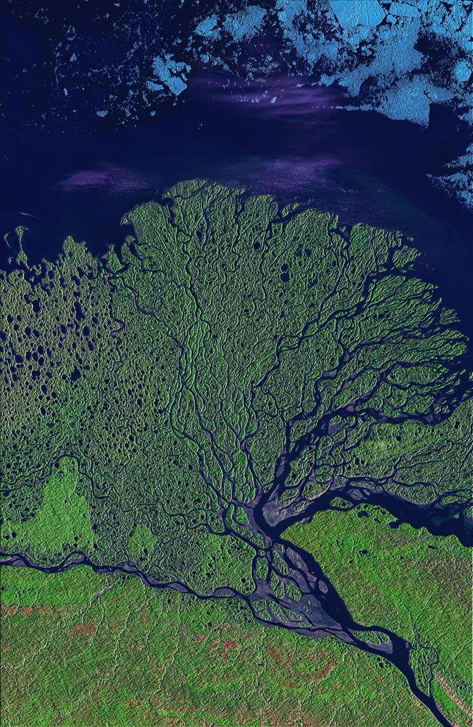
The satellite view of Philadelphia in infrared, from a few days ago, led some people to ask for more false-color imagery of our planet. Here we've got a river delta in the tundra of eastern Siberia, where the River Lena empties into the Arctic Ocean. The image is from mid-summer, when the plants of the tundra were bursting with new growth, thanks to twenty-four hours a day of sunlight. The color scheme here is different from that of the Philadelphia scene but still not closely related to the colors a human eye would detect. The data displayed comes from three sensors on the Landsat satellite: one that detects infrared energy, another that detects near-infrared energy, which is very sensitive to the chemicals associated with growing vegetation, and a third sensor that picks up a part of the visible spectrum. Vegetation is green, exposed rock or soil is pink, wet soil (mud) is purple, and ice is blue.
Even in mid-summer, the sea ice floats close to shore. It will take another month or two for most of the ice to melt and/or wash out to sea, but as soon as it does freezing temperatures will return and ice formation will begin again.
The innumerable ponds and distributary streams are typical of flat places throughout the Arctic tundra, where permafrost just below the surface impairs drainage. Meltwater and rainwater sit on top of the permafrost all summer long, breeding mosquitoes...... which don't show up in the satellite imagery.
birdseye view
Russia
infrared
Siberia
remote sensing
tundra
Landsat
Lena River
delta
river
Arctic Ocean
Jan 3, 2012
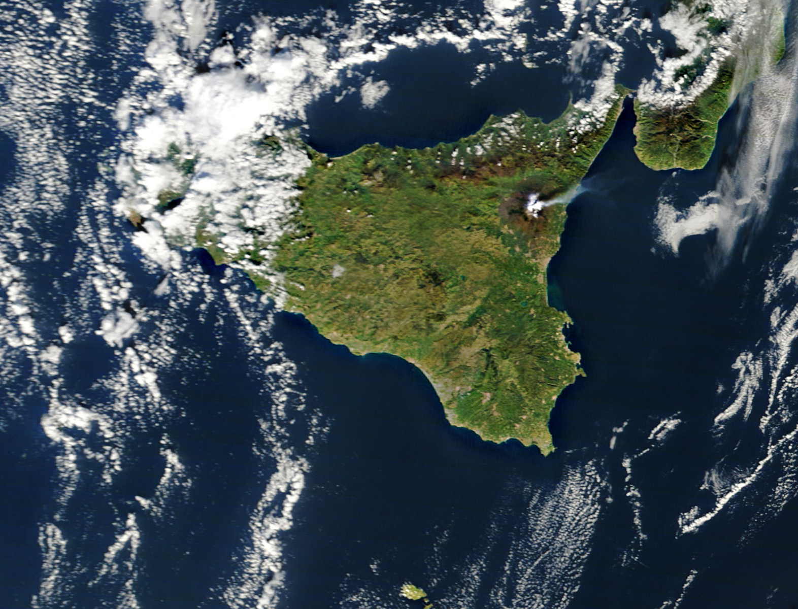
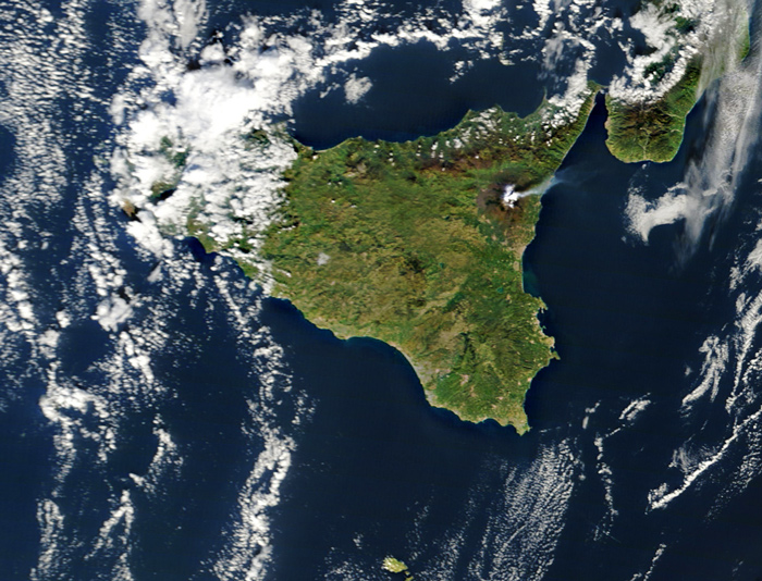 Right around this time last year, Mt. Etna in Sicily started doing this. Again.
birdseye view
volcano
Italy
satellite imagery
remote sensing
clouds
Mt. Etna
Sicily
Mediterranean
(Image credit: NASA MODIS satellite)
Mar 8, 2012
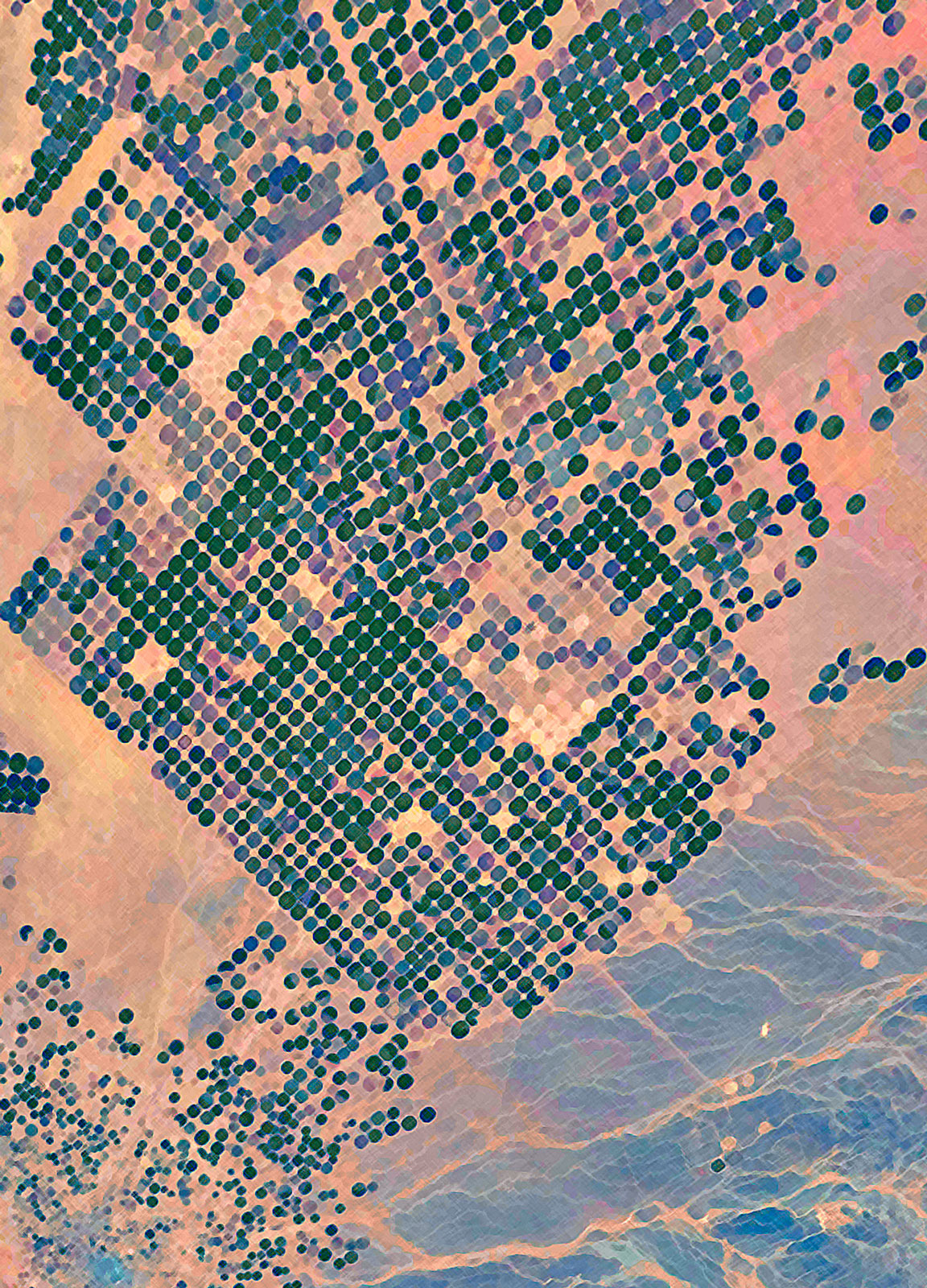
 The desert of northern Saudi Arabia is among the most barren places on earth. But beginning in 1986, when water wells were drilled into deep aquifers, vast stretches of desert land have been irrigated for agricultural use. So much of Saudi Arabia is now farmland that the fields are visible from space, as shown here in this photo taken last week by astronauts on the International Space Station. The circular fields are each about one kilometer in diameter.
This is energy-intensive agriculture; it takes a lot of fossil fuel to pump water from so deep underground and to operate the center-pivot irrigation systems that keep the wheat fields and vegetable patches green despite bone-dry desert air. But Saudi Arabia has a lot of fossil fuel, and its desert agriculture is expanding rapidly.
(The water in the aquifers is itself fossilized, left over from the Ice Age, before this part of the world became so hot and arid.)
birdseye view
desert
remote sensing
astronaut photography
Saudi Arabia
irrigation
crops
(Image credit: International Space Station)
Jun 1, 2012
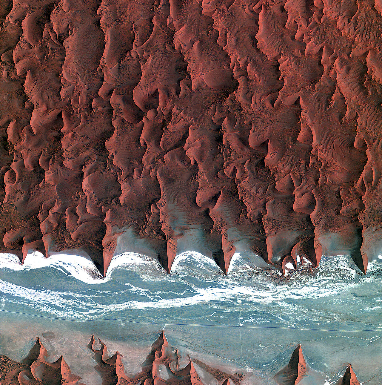
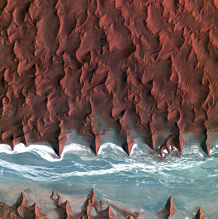
 Southern Namibia, as seen from the Landsat 7 satellite orbiting 700 kilometers above the earth's surface.
birdseye view
Namibia
desert
satellite imagery
remote sensing
wilderness
(Image credit: NASA Landsat 7)
Sep 15, 2012
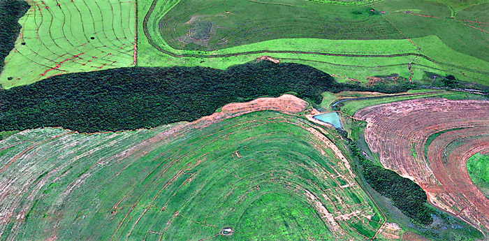 For those who've been wondering: this is what the landscape looks like in extreme northern Paraguay, near the Brazilian border.
landscape
remote sensing
crops
aerial imagery
Paraguay
farmland
Oct 13, 2013
 Well, of course now that our American space program is shut down because of hateful people in the House of Representatives, the brand new Landsat 8 satellite that you and I paid for, which had just started phoning in dramatic new views of our planet, has gone dark. But fortunately, many other countries have legislatures that don't seem to go quite so insane over efforts to help people get medical care, and so new earth imagery from foreign satellites is still available to us.
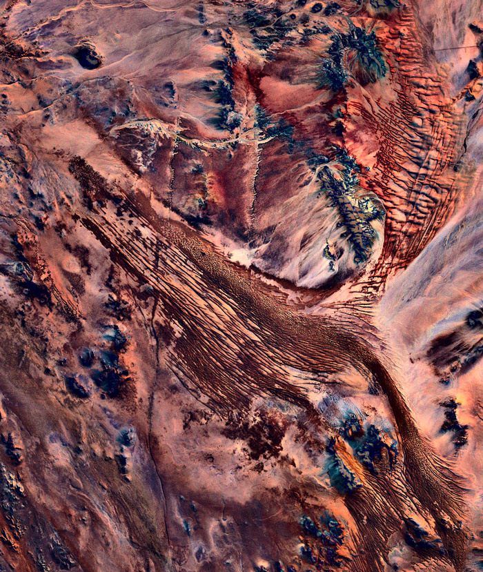
This is the view from Kompsat 2, a Korean satellite, as it crossed southern Africa above the Namib Desert on the morning of October 5. What appears to be blue water is actually an ancient riverbed, almost entirely dry for millions of years; the white streaks are bone-dry salt flats.
Click to zoom in and see roads in the riverbed and some black dots that represent the only vegetation for hundreds of square miles; These desert shrubs survive on groundwater, of which there is hardly any; such as is there is, however, collects deep underneath the riverbed, below the gullies where water does trickle on those rare occasions when it rains here. Annual precipitation is less than half an inch on average, though it is supplemented a bit by coastal fog.
Note the short spur leading off the main road near the middle of the scene and ending at the base of a dune. This is the route to a parking lot at Dune 45, a thousand-foot high sand dune popular with tourists.
birdseye view
Namibia
desert
space
remote sensing
Africa
satellite
Korea
(Image credit: Kompsat 2 via European Space Agency)